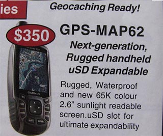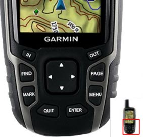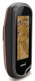

 We have just received some information about a new Garmin outdoor GPS. The rumours are getting stronger that a successor to the 60CSx really is about to appear. In terms of design and operating concept, the new Garmin GPSMAP 62 differs clearly from the current Garmin Oregon and Garmin Dakota units. Unlike these devices, it has no touchscreen. It is operated “conventionally” with buttons. Without the “weak point” of a touchscreen, it would be possible to build the device considerably more ruggedly. Update on 05.09.2010: Click here for the review of the Garmin GPSMAP 62s / st
The first pictures show clear similarities to the ageing Garmin 60CSx, which is still very popular with many outdoor fans precisely because of its reliability and ruggedness.
Garmin GPSMAP 62 available soon on the US market in different versions and colours!
More information and pictures are available. The device had apparently already been listed on the website of the US outdoor retailer Bass Pro. The page has since gone offline again (someone apparently went public with the information a little early). But the pictures and information have of course spread widely on the internet by now. The devices will probably have the following names
Update on 15.06.2010: Today Garmin Germany published the official press release, which confirms the information in this article so far:
The three new GPSmap 62 models are suitable for an extremely wide range of uses, from hiking, biking, mountaineering and geocaching to professional applications. They will go on sale in Germany this summer. The recommended retail prices are 299 euros (GPSmap 62), 399 euros (GPSmap 62s) and 479 euros (GPSmap 62st). More information at www.garmin.de
Garmin GPSMAP 62st and Garmin GPSMAP 62s
Here is the description that could briefly be found at Bass Pro:
- Incredibly sensitive and easy to use
- Preloaded Worldwide DEM basemap plus Topo 100K
- Brilliant 65K color TFT display
- Crisp 160×240-pixel resolution
- 1 GB internal usable memory
- Includes a variety of essential outdoor apps, including compass, altimeter, and wireless
- High-speed USB serial interface
- External GPS output
- MicroSD card slot (card not included)
- Runs 18 hours on two AA batteries (not included)
- $499.99 US
GPSMAP 62 62s (no “t”) are related to that model’s lack of preinstalled 100k topos:
- Preloaded Worldwide DEM basemap
- 1.8 GB internal memory
- $399.99 US
| Devices: |
GPSMAP® 62
|
GPSMAP® 62s
|
GPSMAP® 62st
|
|
| B x H x T: | 6,1 x 16 x 3,6 cm (2,4 x 6,3 x 1,4 Zoll) | 6,1 x 16 x 3,6 cm (2,4 x 6,3 x 1,4 Zoll) | 6,1 x 16 x 3,6 cm (2,4 x 6,3 x 1,4 Zoll) | |
| Display size, W x H: | 4,1 x 5,6 cm (1,6 x 2,2 Zoll); 2,6 Zoll (6,6 cm) Diagonale | 4,1 x 5,6 cm (1,6 x 2,2 Zoll); 2,6 Zoll (6,6 cm) Diagonale | 4,1 x 5,6 cm (1,6 x 2,2 Zoll); 2,6 Zoll (6,6 cm) Diagonale | |
| Display resolution, W x H: | 160 x 240 Pixel | 160 x 240 Pixel | 160 x 240 Pixel | |
| Display type: | Transflektiv, 65.000 Farben, TFT | Transflektiv, 65.000 Farben, TFT | Transflektiv, 65.000 Farben, TFT | |
| Weight: | 260,1 g (9,2 Unzen) inkl. Batterien | 260,1 g (9,2 Unzen) inkl. Batterien | 260,1 g (9,2 Unzen) inkl. Batterien | |
| Battery: | 2 AA batteries (not included); NiMH rechargeables or lithium batteries recommended | 2 AA batteries (not included); NiMH rechargeables or lithium batteries recommended | 2 AA batteries (not included); NiMH rechargeables or lithium batteries recommended | |
| Battery life: | 20 Stunden | 20 Stunden | 20 Stunden | |
| Waterproof: | yes (IPX7) | yes (IPX7) | yes (IPX7) | |
| Floats: | no | no | no | |
| High-sensitivity GPS receiver: | yes | yes | yes | |
| PC interface: | USB and NMEA 0183 compatible | high-speed USB and NMEA 0183 compatible | high-speed USB and NMEA 0183 compatible | |
| RoHS version available: | yes | yes | yes | |
| Basemap: | yes | yes | yes | |
| Preloaded maps: | no | no | yes | |
| Ability to add maps: | yes | yes | yes | |
| Internal memory: | 1,7 GB | 1,7 GB | 500 MB | |
| Accepts memory cards: | no | microSD™ card (not included) | microSD™ card (not included) | |
| Waypoints: | 2000 | 2000 | 2000 | |
| Routes: | 200 | 200 | 200 | |
| Track log: | 10.000 Punkte, 200 gespeicherte Tracks | 10.000 Punkte, 200 gespeicherte Tracks | 10.000 Punkte, 200 gespeicherte Tracks | |
| Automatic routing (turn-by-turn directions on roads): | Yes (with optional maps for detailed roads) | Yes (with optional maps for detailed roads) | Yes (with optional maps for detailed roads) | |
| Touchscreen: | no | no | no | |
| Electronic compass: | no | yes (tilt-compensated, 3-axis) | yes (tilt-compensated, 3-axis) | |
| Barometric altimeter: | no | yes | yes | |
| Camera: | no | no | no | |
| PhotoNavigation: | yes | yes | yes | |
| Picture viewer: | no | no | no | |
| Custom maps compatible: | yes | yes | yes | |
| Geocaching mode: | Yes (paperless) | Yes (paperless) | Yes (paperless) | |
| Outdoor GPS games: | no | no | no | |
| Hunt/fish calendar: | yes | yes | yes | |
| Sun and moon information: | yes | yes | yes | |
| Tide tables | yes | yes | yes | |
| Area calculation: | yes | yes | yes | |
| Custom POIs | yes | yes | yes | |
| Unit-to-unit transfer | no | yes | yes | |
| Garmin Connect™ kompatibel | yes | yes | yes |
More information:
- http://www.gpsfix.net/garmin-gpsmap-62/
- http://www.gpsfix.net/more-gpsmap-62-detail/
- http://gpstracklog.com/2010/05/garmin-gpsmap-62-series-first-pics.html
Here are some pictures ( Source: Radioworld – Bass Pro – gpsfix.net )